
Project Argo in Pacific Region
Argo is a global array of almost 4000 free-drifting profiling floats that measures the temperature and salinity of the upper 2000 metres of the ocean. This allows continuous monitoring of the temperature, salinity, and velocity of the upper ocean, with all data being relayed and made publicly available within hours after collection.
Argo Maps and Tools
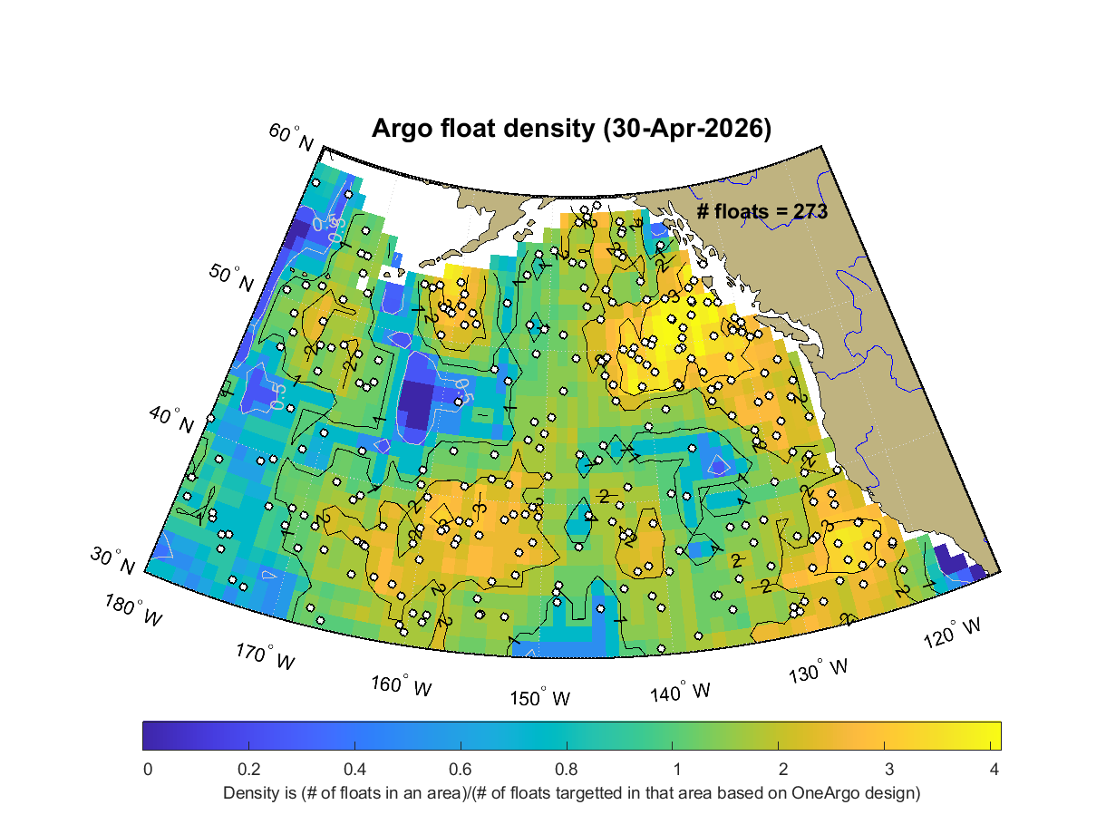
Map showing the current float density in the Gulf of Alaska.
Click on the diagram above to get a larger version.
Argo Float Trajectory Movies
Last update: 27th Aug. 2018
For the following movies of float motion in the oceans, the dot indicates the "current" location of the float as given by the date counter, and the tail is a previous history, typically 80 or 100 days.
Argo in the Gulf of Alaska
- Line-P temperature & salinity sections as seen by Argo
- Near surface stratification at Station Papa interpolated from Argo
This project should be viewed as collaborative with two other projects, Jason and Godae. Jason is the follow-on mission to Topex-Poseidon and should supply sea-surface elevation globally. Thus, the combination of Jason plus Argo supplies maps every 10 days of the internal dynamics of the ocean, globally. The project GODAE is the Global Ocean Data Assimilation Experiment and the intention is to develop computer models that will assimilate the complete Argo and Jason data sets and allow a test of our ability to forecast ocean climate.
Page details
- Date modified: